A research team reports a drill bit breaking beneath a boat-shaped ridge in eastern Turkey. Online, that becomes another reason to ask whether Noah’s Ark has finally been found. The answer, as of 29 September 2026, is that the public evidence examined here does not establish that discovery. New fieldwork has produced claims worth checking, while the identification of an ancient vessel remains unproven. [1] [2]
The focus is Durupınar, a formation near Doğubayazıt that has attracted Ark claims for decades. September reports describe radar surveys, drilling, and samples awaiting analysis. To understand the story, follow the steps between a striking shape, a measured anomaly, a recovered material, and a defensible archaeological conclusion. Those steps explain both the interest and the uncertainty. [3]
What is new in the September 2026 reports?
In a press release dated 23 September, Noah’s Ark Scans reported core sampling to depths of up to 18 metres. It described a drill bit breaking around 4–5 metres below the surface and proposed mineralized or petrified wood as a possibility requiring laboratory testing. It also outlined plans for a camera-equipped underground device called GOPHER. These are statements from the organization promoting and supporting the investigation; the release is not an independent scientific assessment. [1]
Anadolu Agency’s 19 September reporting identified archaeologist Cenker Atila of Sivas Cumhuriyet University as the project leader, working with support from Andrew Jones. Atila described mapping, radar investigations, and soil sampling, with laboratory work expected to continue through the winter. His account distinguished cavities that might represent rooms or corridors from structures already established as such. [3]
The timing deserves care. An İHA report carried by Bizim Sivas on 23 September said the 2026 field season had concluded. Sözcü reported on 28 September that Atila had challenged social-media claims of complete proof and said analyses were continuing. A newly published drilling announcement therefore should not automatically be read as a live report that drilling has only just started. [9] [2]
The boat-shaped formation behind the headlines
The site entered modern investigations after İlhan Durupınar identified the feature in aerial photographs in 1959. Its outline remains the easiest part of the story to recognize: an elongated form with raised margins, set within a much larger landscape. The modern name identifies the formation and its history of investigation; it does not settle the origin of the shape. [3]
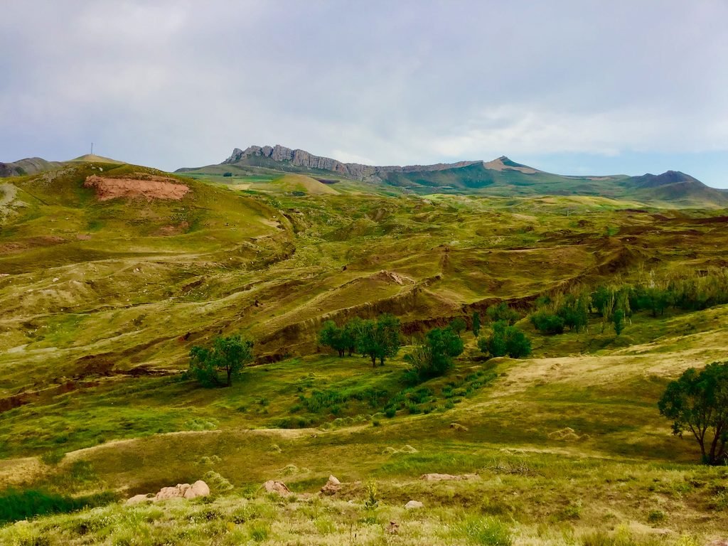

A surface photograph answers a limited but useful question: what does the place look like? It does not show the material beneath the ridge or establish how that material formed. A familiar outline can suggest a hypothesis. Archaeological identification requires evidence that survives comparison with natural explanations.
What can radar actually reveal?
Ground-penetrating radar sends electromagnetic pulses into the ground and records returning reflections. As Historic England explains, closely spaced survey lines can be processed into slices and three-dimensional representations. Geophysical investigation depends on measurable contrasts in physical properties. Its strength is the ability to locate patterns and possible buried features before opening the ground. [4]
Electrical resistance measurements respond to conditions including moisture. Interpreting a subsurface pattern therefore involves the surrounding geology and the properties of the material being measured. A clear-looking computer image is the result of measurement, processing, and interpretation; it is not a camera photograph of a buried room. [4]
At Durupınar, this distinction changes the question. Instead of asking whether a coloured line resembles a wall, ask whether the proposed wall has been independently demonstrated. Where is it? What is it made of? How does it connect to adjoining features? Can natural layering or fractures explain the same observations? These are the questions that further sampling and publication must address.
Does the broken drill bit prove petrified wood?
The drilling announcement presents petrified wood as a possibility for future testing. It does not provide a completed laboratory identification of the material that stopped the drill. Treating the broken bit as proof skips the very analysis the team says it intends to undertake. [1]
Fossil wood can preserve identifiable microscopic anatomy. The US National Park Service’s account of research at Florissant describes examining sections in three orientations to reveal cellular structures and compare them with those of trees. That illustrates the kind of material evidence that makes a wood identification meaningful. Resistance encountered during drilling does not supply those anatomical observations. [5]
Even confirmed wood would open another question: how did it get there? Wood in a deposit and timber used in a vessel are different archaeological propositions. Evidence of shaping, construction, connected structural elements, and a well-documented find context would matter. Calling a sample organic also leaves its source unresolved; organic material is a broad category, not a synonym for ship timber.
What the earlier geological investigation found
The strongest challenge to the Ark interpretation comes from work on the materials themselves. In a 1996 paper in the Journal of Geoscience Education, Lorence G. Collins and David F. Fasold concluded that the formation was natural. Microscopic examination identified a supposed iron fitting as mineral material rather than manufactured metal. Samples described as structural remains did not demonstrate petrified timber. [6]
The paper interpreted the outline through folding, erosion, and mineral concentrations. Its proposed geological explanation included a doubly plunging syncline: rock layers folded into a trough that closes toward both ends. The authors combined specimen analysis with photographs and geological interpretation; they also identified aspects requiring further field examination. [6]
That study predates the 2026 campaign. It cannot analyse samples that had not yet been collected. Its importance is that a natural explanation already rests on published observations. A new interpretation must engage with that evidence and explain which findings it overturns, rather than treating the earlier work as if it never happened.
Why matching the biblical description is not enough
Genesis 6:14–16 describes an Ark made from wood, with internal divisions and three levels. It gives dimensions in cubits: 300 long, 50 wide, and 30 high. These details explain why supporters compare dimensions and interpreted underground patterns with the biblical account. The passage is a source for the narrative, while the identity of a particular formation remains a separate evidential question. [7]
The project’s website strongly promotes the Ark interpretation and describes a formation approximately 157 metres long. It also solicits support and advertises tours. Readers should know that perspective when assessing its presentation. An investigator’s commitment can motivate fieldwork; the resulting interpretation still needs data and independent scrutiny. [8]
A proposed match must explain more than one attractive feature. Length, internal arrangement, material, age, and construction should fit together in a documented account. Selecting the similarities while leaving contrary geological evidence unanswered would weaken the case. Respect for the religious significance of the story is compatible with asking those concrete questions.
A CGI Ark is an illustration, not a recovered object
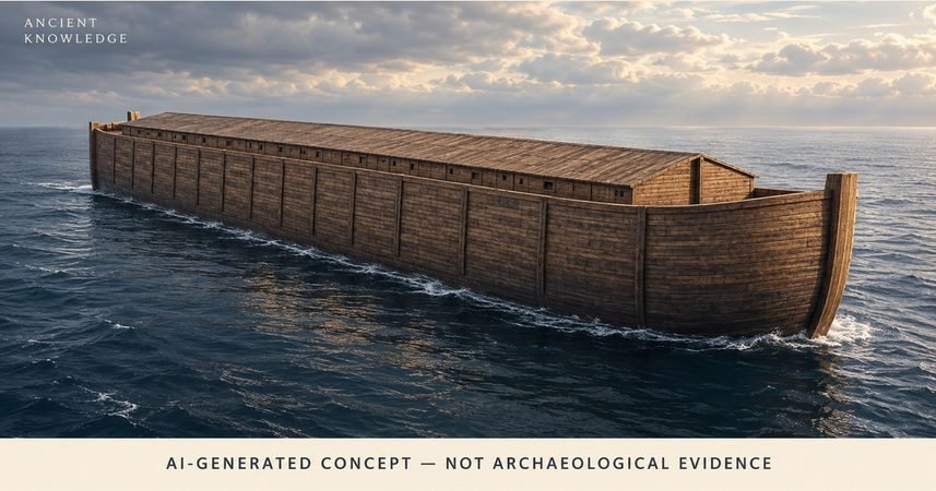
The Ark illustration accompanying this article is an AI-generated concept. It imagines a wooden vessel for editorial context. Its hull, roof, lighting, and setting are visual choices, not measurements from the Durupınar investigation. It should not be read as a reconstruction of a confirmed wreck.
The distinction also applies to images shared elsewhere. A photograph records the visible site. A radar visualization represents processed survey measurements. An interpreted model adds a proposed explanation. An artistic rendering imagines a scene. Before using an image as evidence, identify which of those things it actually is.
What would move the investigation forward?
The most informative next publication would connect observations to conclusions transparently: sample locations and depths, handling records, laboratory methods, identified materials, dating where appropriate, and comparisons with the surrounding terrain. Survey data and geological interpretations should be available in enough detail for qualified researchers to evaluate competing explanations.
There are two major steps to keep separate. Demonstrating a human-built vessel would be an archaeological finding. Identifying that vessel specifically with Noah’s Ark would require an additional argument. Neither step follows automatically from a boat-like outline, a promising scan, or the announcement of a research permit.
For now, the useful news is that investigators have reported new sampling and are pursuing analysis. The discovery claim remains unproven in the material reviewed here. Follow the sources below for published results, and ask what each new piece of evidence establishes before accepting the headline attached to it.
Sources and further reading
- Noah’s Ark Scans, distributed through GlobeNewswire. Core Drilling Begins at Durupinar Noah’s Ark Site, Drill Bit Shatters on Possible Layer of Petrified Wood. 23 September 2026. Project press release; claims await independent validation. Read source
- Sözcü, Haber Merkezi. Nuh’un Gemisi gerçekten Ağrı Dağı’nda mı, Nuh’un Gemisi bulundu mu? Prof. Dr. Cenker Atila’dan flaş açıklama. 28 September 2026. Reporting on Atila’s clarification; original social-media statement not retrieved. Read source
- Abdullah Söylemez, Anadolu Agency. Ağrı’da Nuh’un Gemisi çalışmaları uluslararası belgesellere konu oluyor. 19 September 2026. Original reporting and interview. Read source
- Historic England. Geophysical Techniques. General explanation of survey methods. Read source
- US National Park Service, Florissant Fossil Beds National Monument. Studying ancient patterns. Updated 18 September 2022. General explanation of fossil-wood identification. Read source
- Lorence G. Collins and David F. Fasold. Bogus ‘Noah’s Ark’ from Turkey Exposed as a Common Geologic Structure. 1996. Journal of Geoscience Education 44(4), pp. 439–444; full author-hosted reproduction at California State University, Northridge. DOI: 10.5408/1089-9995-44.4.439. Read source
- Genesis, King James Version, via Bible Gateway. Genesis 6:14–16. Primary text for the biblical description; not archaeological evidence for the formation. Read source
- Noah’s Ark Scans. Noah’s Ark Scans: Guardians of the Ark. Project website consulted 29 September 2026; represents the organization’s perspective. Read source
- İHA reporting, published by Bizim Sivas; editor Gülşah Akkaş Yaman. Ağrı Dağı’nda Nuh’un Gemisi araştırmalarında yeni bulgular ortaya çıktı. 23 September 2026. Used for reported completion of the field season. Read source